The complete guide
Sikkim tourism: the complete, honest guide for first-time visitors
Sikkim is a small Himalayan state wedged between Nepal, Tibet and Bhutan, with Mt Kanchenjunga on its skyline, sacred lakes above 17,000 ft, a border pass you can stand on, rhododendron valleys, 300-year-old monasteries and a 100% organic food culture. It is also the state where more trips go wrong at checkposts than anywhere else in India. This guide, written and checked by Ridge & River Sikkim Team on 2026-10-29, tells you what to expect and links to a deep page for every place, permit and price.
Sikkim in one minute
- Capital: Gangtok (5,500 ft), 124 km and 4.5–5.5 hours from Bagdogra airport.
- Four circuits: East (Gangtok, Tsomgo, Nathula, Silk Route), North (Lachen, Lachung, Gurudongmar, Yumthang), West (Pelling, Yuksom, Khecheopalri), South (Namchi, Ravangla, Temi).
- Altitude range: 3,950 ft at Mangan to 17,800 ft at Gurudongmar; oxygen is 40% thinner at the top.
- Permits: none for Indians in towns, Protected Area Permits for all high passes and North Sikkim; RAP/ILP for every foreign passport.
- Roads: 20–28 km/h average; checkposts close at 10 AM (3rd Mile) and 4 PM (Toong); Nathula shuts on Mondays and Tuesdays.
- Money: cabs are per vehicle (about ₹6,800/day for an SUV), stays ₹748–₹11,199 a night, no ATMs beyond Mangan.
- Size: 7,096 km², smaller than Delhi NCR, with about 7 lakh people and three official community languages (Nepali, Bhutia, Lepcha) alongside Hindi and English.
Sikkim joined India in 1975 and has spent the fifty years since protecting what makes it different: a plastic-bottle ban in the high valleys, a complete switch to organic farming certified in 2016, Khangchendzonga National Park listed as a UNESCO World Heritage site the same year, and a permit system that keeps the border passes and the North quiet. Those rules are the reason the place is worth visiting and the reason first-time trips go wrong. Read the permit section twice.
When to visit, month by month
March–June
Rhododendrons in Yumthang and Barsey, snow still at Zero Point and Nathula, 13–22°C days. May is crowded.
July–September
Monsoon: landslides close North Sikkim and Nathula. Gangtok, Pelling and the South are lush and 25–50% cheaper.
October–November
Clearest Kanchenjunga views of the year, cherry blossoms at Temi, all routes open. Peak demand in October.
December–February
Reliable snow at Tsomgo, Zuluk, Lachung and Zero Point; Tsomgo freezes. Keep a buffer day for blizzard closures.
| Month | Weather | Snow | Open | Note |
|---|---|---|---|---|
| Jan | Cold, dry | Yes, everywhere high | All (blizzard pauses) | Frozen Tsomgo; −10% tariffs |
| Feb | Cold, dry | Yes | All | Losar at the monasteries |
| Mar | Mild | Nathula, Zero Point | All | Blooms low, snow high |
| Apr | Mild | Zero Point | All | Peak rhododendrons |
| May | Warm, showers | Fading | All | Busiest; +15% |
| Jun | Warm, rain builds | No | All until mid-month | First half only |
| Jul | Heavy rain | No | Gangtok, Pelling, South | North and Nathula closed; −25% |
| Aug | Heaviest rain | No | Gangtok, Pelling, South | Pang Lhabsol; cheapest |
| Sep | Rain easing | No | North reopens late | Quiet, green, cheap |
| Oct | Dry, clear | Dusting late | All | Best views; Puja crowds, +15% |
| Nov | Dry, clear | Zero Point, Nathula | All | Our pick: views, blossoms, space |
| Dec | Cold, dry | Yes after mid-month | All | Losoong; Christmas week fills |
Two patterns decide everything. The monsoon (July to mid-September) closes the North Sikkim highway and the Nathula road for days at a time, so those two circuits belong to October–May. And the high passes keep snow long after the plains have forgotten winter: Zero Point and Nathula are white into April, which is why March and April can give you flowers in the valleys and snowballs on the same day. Full detail, festival dates and packing lists are in the month-by-month guide, and the planner applies the season rules automatically when you pick a month.
Where to go: the four regions and all 30 places
East Sikkim
The capital, sacred Tsomgo Lake, the Nathula border and the Old Silk Route
East Sikkim is where every trip starts. Gangtok is the permit and cab hub; Tsomgo Lake, Baba Mandir and Nathula Pass make a classic day loop; and the Old Silk Route through Aritar, Zuluk, Nathang Valley and Kupup is the most dramatic 2–3 night circuit in the state. Altitudes run from 4,900 ft at Aritar to 14,140 ft at Nathula, so plan permits and acclimatisation.
North Sikkim
Lachen, Lachung, Gurudongmar Lake, Yumthang Valley and Zero Point
North Sikkim is raw high-Himalayan country reached on a single Y-shaped highway: Gangtok to Mangan and Chungthang, then left to Lachen for Gurudongmar Lake and Chopta Valley, or right to Lachung for Yumthang, Zero Point and Katao. Every stop beyond Chungthang needs a Protected Area Permit, a Sikkim-registered SUV, and respect for the 4 PM Toong checkpost and 4 AM Gurudongmar departure.
West Sikkim
Pelling, Yuksom, Khecheopalri and the closest Kanchenjunga views
West Sikkim gives you Kanchenjunga at arm's length from Pelling, 300-year-old monasteries, royal ruins, a glass skywalk and the Goecha La trek base at Yuksom, all with no permits for Indian citizens and no thin-air worries. It is the best region for families with small children, seniors and foreign nationals.
South Sikkim
Namchi, Ravangla, Temi Tea Garden and the Borong hot springs
South Sikkim lies between Gangtok and Pelling, so its giant statues, organic tea slopes, cherry blossoms and hot springs fit naturally into a transfer day or a slow two-night stay. Everything sits below 7,000 ft and needs no permit.
Six places everyone asks about
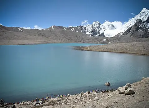
Day excursion · sleep in Lachen
Gurudongmar Lake
One of the highest sacred lakes on earth at 17,800 ft — a 4 AM start, 45 minutes at the top.
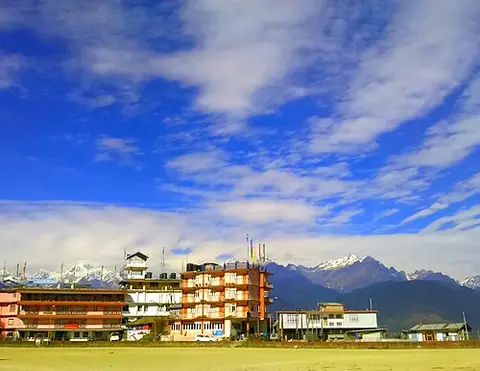
Day excursion · sleep in Lachung
Yumthang Valley
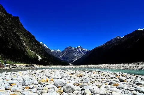
Sikkim's Valley of Flowers — 24 rhododendron species, a hot spring and yak pastures.
Every destination, by region and altitude
Each link opens a full guide with photos, drive time from Gangtok, permit and ID rules, the checkpost cutoff that governs your start time, where you sleep, and stays with tariffs.
East Sikkim (9)
- Aritar 4,900 ft — Lampokhari Lake boating and an 1895 Dak Bungalow — the gentle first night of the Silk Route.
- Rumtek 5,000 ft — The Karmapa's monastery and a quiet terraced-hill base 24 km from Gangtok.
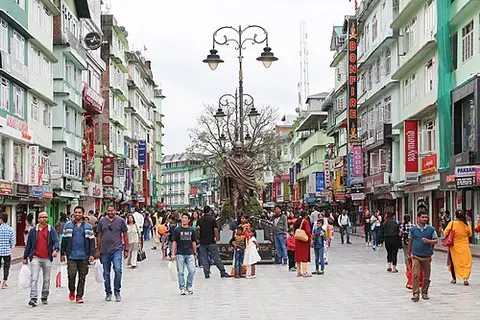
- Gangtok 5,500 ft — Sikkim's capital and the base for every permit, cab and high-altitude day trip.
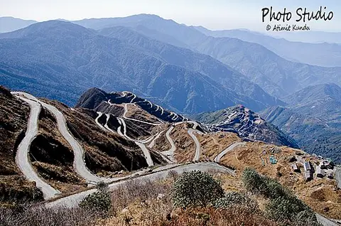
- Zuluk 10,000 ft — 32 hairpin bends and a Thambi Viewpoint sunrise — the heart of the Old Silk Route.
- Tsomgo Lake 12,400 ft — The sacred glacial lake 38 km from Gangtok — yak rides, a ropeway and a frozen surface in winter.
- Kupup Lake 13,000 ft — The elephant-shaped lake beside the world's highest golf course.
- Baba Mandir 13,200 ft — The army shrine to Baba Harbhajan Singh at 13,200 ft, between Tsomgo and Kupup.
- Nathang Valley 13,500 ft — The 'Ladakh of East India' — a 13,500 ft plateau of snow in winter and wildflowers in summer.
- Nathula Pass 14,140 ft — The Indo-China border pass at 14,140 ft on the Old Silk Route — closed Mondays and Tuesdays.
North Sikkim (10)
- Mangan 3,950 ft — North Sikkim's district headquarters, cardamom capital and the last town with ATMs.
- Singhik 5,200 ft — An uninterrupted Kanchenjunga and Siniolchu panorama above the Teesta gorge.
- Chungthang 5,600 ft — Where the Lachen and Lachung rivers meet and the road forks — the Toong checkpost town.
- Lachung 8,800 ft — The apple-orchard village that is base camp for Yumthang, Zero Point and Katao.
- Lachen 9,000 ft — The mandatory overnight base at 9,000 ft for the 4 AM run to Gurudongmar Lake.
- Yumthang Valley 11,800 ft — Sikkim's Valley of Flowers — 24 rhododendron species, a hot spring and yak pastures.
- Chopta Valley 13,200 ft — Alpine meadows and frozen streams between Thangu and Gurudongmar.
- Katao 15,000 ft — The 'Switzerland of Sikkim' — a snow ridge 28 km from Lachung under army control.
- Zero Point 15,300 ft — Yumesamdong, where the civilian road ends at 15,300 ft — near-guaranteed snow in spring.
- Gurudongmar Lake 17,800 ft — One of the highest sacred lakes on earth at 17,800 ft — a 4 AM start, 45 minutes at the top.
West Sikkim (7)
- Rinchenpong 5,576 ft — A heritage ridge where Tagore stayed — Reesum Monastery, Poison Lake and golden sunsets.
- Yuksom 5,800 ft — Sikkim's first capital (1642) and the trailhead for the Goecha La and Dzongri treks.
- Khecheopalri Lake 6,000 ft — The sacred wish-fulfilling lake where birds keep the water free of leaves.
- Geyzing 6,500 ft — West Sikkim's district town and the quieter Yangtey ridge, 10 km from Pelling.
- Uttarey 6,600 ft — A quiet Nepal-border valley with Sikkim's highest gorge bridge and the Singalila trek.
- Pelling 7,200 ft — The closest dawn view of Kanchenjunga, a glass skywalk and 300-year-old monasteries.
- Barsey Rhododendron Sanctuary 10,000 ft — A 4 km forest walk through blooming rhododendrons facing Kanchenjunga.
South Sikkim (4)
- Temi Tea Garden 4,800 ft — Sikkim's only tea estate — organic slopes, a cherry-blossom avenue in November and a heritage bungalow.
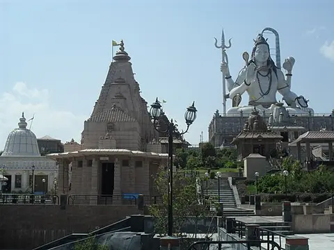
- Namchi 5,500 ft — Char Dham's 108 ft Shiva, the 118 ft Guru Padmasambhava on Samdruptse and wheelchair-friendly courtyards.
- Borong 5,800 ft — Natural sulphur hot springs, birding trails and Mount Pandim views near Ravangla.
- Ravangla 7,000 ft — The 130 ft Buddha Park against Kanchenjunga, Ralang Monastery and Himalayan birding.
How many days, and realistic itineraries
Distances lie. Gangtok to Lachen is 108 km and takes six hours; Gurudongmar is never a day trip; Pelling is "125 km" and most of a day. Plan by nights, not kilometres, and let the checkposts set your mornings. Our packages are generated by the same engine as the planner and follow these rules:
- 4 days: Gangtok, Tsomgo, Baba Mandir, Nathula, Rumtek. The classic long weekend.
- 6 days: add Lachen, Gurudongmar, Lachung, Yumthang and Zero Point, with a Gangtok buffer night before the flight.
- 7 days: the 6-day route plus a Pelling night and the Temi–Ravangla–Namchi drive. Our recommended first trip, written day by day.
- 8 days: two nights in Pelling with Khecheopalri and Yuksom.
- 10 days: start on the Silk Route through Aritar, Zuluk, Nathang and Kupup, then North and West.
- Senior and kid-safe: nothing above 8,000 ft at night, no permits, car-porch hotels.
- Foreigner / OCI: the legally permitted circuit with group permits.
Three rules hold for every route. Sleep a night in Gangtok before any pass above 12,000 ft. Put a Gangtok night between North Sikkim and your flight, because the highway closes without notice. And never plan Nathula on a Monday or Tuesday.
Permits, the Aadhaar rule and foreign passports
The single most important fact on this site: Aadhaar and PAN cards are not accepted for Sikkim permits. Carry an original Voter ID, Passport or Driving Licence, two passport photos per permit route, and a birth certificate or passport for children. Permits are filed through a registered operator 24 hours ahead (48 in May and October) and checked at 3rd Mile for Tsomgo and Nathula, at Toong for the North and at Rongli for the Silk Route.
What Indian citizens need
- No permit: Gangtok, Rumtek, Temi, Ravangla, Namchi, Pelling, Yuksom, Khecheopalri, Rinchenpong, Aritar, Mangan and the other towns.
- Protected Area Permit: Tsomgo Lake, Baba Mandir, Nathula (plus a vehicle permit; closed Mon–Tue), the Silk Route beyond Rongli (Zuluk, Nathang, Kupup), and all of North Sikkim beyond Mangan (Lachen, Gurudongmar, Lachung, Yumthang, Zero Point, Katao, Chopta).
- Forest ticket only: Barsey Rhododendron Sanctuary, Khangchendzonga National Park day walks.
What foreign nationals, NRIs with foreign passports and OCI holders need
Everyone entering on a foreign passport needs a Restricted Area Permit (RAP/ILP), free, valid 30 days and extendable. It is issued on arrival at the Rangpo or Melli checkposts, at Sikkim Tourism offices in Delhi, Kolkata and Siliguri, or online through e-FRRO. With it you can visit Gangtok, Pelling, the South and West freely. Tsomgo, Lachung and Yumthang are allowed in a group of two or more through a registered agency. Nathula, Gurudongmar, Zuluk, Nathang, Kupup and Katao are closed to foreign passports; no agency can get around this. The permit and ID guide has the 30-destination table and the 10-second checker tells you exactly what to carry.
What a Sikkim trip costs
Because cabs are priced per vehicle, group size matters more than hotel choice. A private SUV runs about ₹6,800 a day; North Sikkim needs a dedicated SUV for 3–4 days (₹24,000–₹64,000 depending on whether Lachen is included). Listed stays range from ₹748 at a Gangtok budget hotel to ₹11,199 at the Temi tea bungalow, with homestays at ₹1,400–₹3,200 including meals. Add about ₹650 a head for permits and tickets, ₹2,500 for the Nathula permit and ₹3,500–₹4,000 per vehicle for Zero Point. In round numbers a 6-day Gangtok and North Sikkim trip is ₹20,000–₹26,000 per person for six friends in budget stays and ₹23,000–₹31,000 for a family of four mid-range, excluding flights. The trip cost guide breaks every line down with the seven ways to spend less; the live budget calculator itemises it for your own plan; the stays directory lists all 120 properties and the cab rate card shows every route.
How to reach Sikkim and get around
Ninety-five percent of visitors come through West Bengal. Bagdogra airport (IXB) has daily flights from every metro and is 124 km, 4.5–5.5 hours, from Gangtok up the Teesta valley; New Jalpaiguri (NJP) station is 120 km with Rajdhani, Shatabdi and Vande Bharat services; Siliguri's SNT terminus runs buses (₹200–₹350) and shared jeeps (₹500–₹800 a seat). Pakyong airport, 30 km from Gangtok, has had no scheduled flights since June 2024, so do not plan around it. Prepaid taxis at Bagdogra cost ₹3,500–₹5,500 for a small car and ₹4,500–₹7,500 for an SUV; try to land by early afternoon because the hill road is slow and unlit after dark.
Inside the state there are no app cabs. Every taxi belongs to a local association with a published route card, out-of-state and self-drive cars cannot enter the permit zones, and the roads average 20–28 km/h. Only BSNL has signal in Lachen and Lachung, nothing works at the passes, and the last ATM is in Mangan, so withdraw ₹6,000–₹10,000 per person in small notes in Gangtok. Single-use plastic bottles are banned with fines up to ₹5,000 in the North; carry a flask. Full details, the gateway comparison and the SIM coverage table are in the how to reach and cabs guide.
Altitude, health and safety
Sikkim is one of India's safest states for solo travellers and families; the hazards are physical, not human. Above 12,000 ft the air carries 35–40% less oxygen than at sea level. Sleep a night in Gangtok before Tsomgo or Nathula and a night in Lachen or Lachung before Gurudongmar, Zero Point or Katao; drink three litres a day; skip alcohol the night before a pass; keep a portable oxygen can from an MG Marg pharmacy in the car. Children under 5 are not permitted at Gurudongmar and seniors over 60 should carry a fitness certificate; the senior and kid-safe route stays below 8,000 ft at night. Mountain sickness symptoms, a pounding headache, nausea or confusion, mean descend, not rest. Army medical posts at Giagong, Sherathang and Kupup give free oxygen. Dial 112 in an emergency; STNM Hospital in Gangtok is the referral hospital for the state. Travel insurance with evacuation cover is cheap and worth it.
Festivals, monasteries, food and treks
Monasteries and culture
Sikkim was a Buddhist kingdom until 1975 and its monasteries are still working institutions, not museums. Rumtek, 24 km from Gangtok, is the seat of the Karmapa lineage; Pemayangtse above Pelling is the state's oldest Nyingma monastery and its Zangdok Palri model took five years to carve; Tashiding near Yuksom holds the Bumchu water ceremony; Enchey in Gangtok dances cham for Losar. Yuksom itself is where the first Chogyal was crowned in 1642. Ask before photographing inside prayer halls, walk clockwise around chortens and mani walls, and visit in the morning when the monks are chanting.
Festival calendar
- Losar (Feb–Mar): Tibetan new year; cham dances at Rumtek and Enchey.
- Bumchu (Feb–Mar): the sacred vase opened at Tashiding.
- Saga Dawa (May–Jun): Buddha's birth and enlightenment; scripture processions in Gangtok.
- Pang Lhabsol (Aug–Sep): Sikkim's own festival for Kanchenjunga as guardian deity.
- Losoong / Namsoong (Dec): Bhutia and Lepcha harvest new year; archery.
- Temi cherry blossom (Nov) and the Yumthang rhododendrons (Apr–May): nature's own festivals.
Food
Momos and thukpa are everywhere, but Sikkimese food is more than that: phagshapa (pork with radish and dried chilli), gundruk and sinki (fermented greens and radish), sel roti (rice-flour rings) with achar, chhurpi cheese in soups, nettle and fern-shoot curries in spring, and Temi tea, the state's only estate. Tongba, millet beer sipped through a bamboo straw, warms a Lachung evening. Everything is organic by law since 2016. Homestays in the North and on the Silk Route serve the best meals of any trip; in Gangtok, MG Marg and the Lal Bazaar lanes are the places to eat.
Treks
Sikkim's classic trek is Goecha La from Yuksom through Tshoka and Dzongri to the foot of Kanchenjunga, 8–10 days in April–May or October–November, inside Khangchendzonga National Park with permits and a registered guide. Dzongri alone is a 4–5 day version with the same views. The Barsey rhododendron walk from Hilley is a 4 km day hike at its best in April, and the Singalila ridge toward Phoktey Dara from Uttarey gives Everest-to-Kanchenjunga panoramas in a 3–4 day trek. Green Lake in the North needs special permits and a full expedition setup. We arrange guides, porters and park permits for all of them from the planner's booking box; tell us the dates.
Planning guides
Each of these goes deeper on one question tourists ask most, with the same facts and prices as this guide.
- Best time to visit Sikkim — Month by month: snow, blooms, clear views, monsoon closures and prices.
- 7-day Sikkim itinerary — Gangtok, Nathula, Gurudongmar, Yumthang and Pelling, day by day.
- Sikkim trip cost — Per-person budgets for 4 to 10 days, line by line.
- North Sikkim tour guide — Lachung, Lachen, Gurudongmar, Yumthang and Zero Point: routes, permits and costs.
- Nathula Pass permit — Documents, fees, closed days and the 3rd Mile cutoff.
- Sikkim permits for foreigners — RAP/ILP, group PAPs and which places are closed to foreign and OCI passports.
- Bagdogra to Gangtok — Taxi fares, shared jeeps, buses, the helicopter and how long it really takes.
Sikkim tourism FAQs
What is Sikkim famous for?
Mt Kanchenjunga (8,586 m), the world's third-highest peak; high sacred lakes like Gurudongmar and Tsomgo; the Nathula border pass; rhododendron valleys; Buddhist monasteries such as Rumtek and Pemayangtse; and being India's first fully organic state.
How many days do I need for Sikkim?
4 days for Gangtok with Tsomgo and Nathula, 6 days to add North Sikkim, 7 days to add a Pelling night, 8 days for the South and West, and 10–12 days for everything including the Silk Route.
Is Sikkim expensive?
Transport is the big cost because cabs are per vehicle. A family of four on a 6–7 day mid-range trip spends about ₹23,000–₹31,000 per person; a group of six about ₹20,000–₹26,000; a solo traveller using shared jeeps about ₹15,000–₹18,000.
Do I need a permit to visit Sikkim?
Indians need no permit for Gangtok, Pelling and South Sikkim but a Protected Area Permit for Tsomgo, Nathula, the Silk Route and North Sikkim. Foreigners need a free RAP/ILP to enter and group permits for protected areas.
When does it snow in Sikkim?
December to February is most reliable at Tsomgo, Nathula, Zuluk, Lachung, Yumthang and Zero Point; spring (March–April) still has snow at Zero Point and Nathula.
Which is the best month to visit Sikkim?
October and November for clear Kanchenjunga views with every region open; March and April for rhododendrons with snow still at the top; January and February for guaranteed snow. Avoid July and August for North Sikkim and Nathula.
Is Aadhaar accepted for Sikkim permits?
No. Protected Area Permits are filed against original Voter ID, Passport or Driving Licence with two photos per person; Aadhaar and PAN are refused at the counters. Children need a birth certificate or passport.
Can foreigners visit Nathula and Gurudongmar?
No. Nathula, Gurudongmar, Zuluk, Nathang, Kupup and Katao are closed to foreign passports and OCI holders. Tsomgo, Lachung and Yumthang are allowed in a group of two or more through a registered agency.
How do I reach Sikkim?
Fly to Bagdogra (124 km, 4.5–5.5 hours to Gangtok) or take a train to New Jalpaiguri (NJP), then a prepaid taxi or shared jeep. Pakyong airport near Gangtok has had no scheduled flights since June 2024.
Is Sikkim safe for solo travellers and families?
Yes; it is one of the safest states in India. The real risks are altitude above 12,000 ft, mountain roads after dark and monsoon landslides, all of which good planning avoids.